Файл:Europe Location Georgia uncontrolled highlighted.svg

Size of this PNG preview of this SVG file: 600 × 600 pixels. нэгъуэщӀ разрешенэхэр: 240 × 240 pixels | 480 × 480 pixels | 768 × 768 pixels | 1,024 × 1,024 pixels | 2,048 × 2,048 pixels.
Файлым и къежьапӀэр (SVG файл, номиналу 1,024 × 1,024 пиксел, файлым и инагъыр: 520 KB)
КӀэщӀу зытеухуар
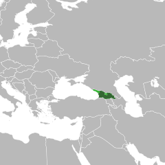
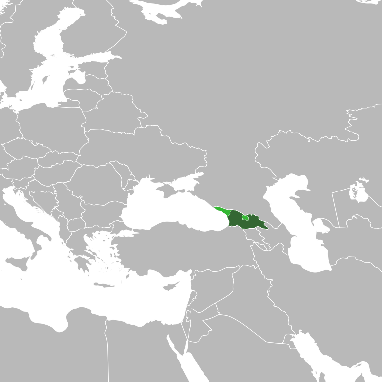
| Зытеухуар | Georgia in dark green, with the uncontrolled Abkhazia and South Ossetia in light green |
| Махуэр | |
| КъежьапӀэр | File:BlankMap-World6.svg |
| Лэжьыгъэр зи Ӏэдакъэ щӀэкӀар | en:User:Canuckguy, дополнительные изменения: Николай Сидоров (transfered from ru-wiki) |
| Other versions | Derivative works of this file: Georgia (orthographic projection with inset).svg |
.svg)
Лэжьыгьэ бгъэзэщӀэну хуит узыщӀ тхылъ
| I, the copyright holder of this work, release this work into the public domain. This applies worldwide. In some countries this may not be legally possible; if so: I grant anyone the right to use this work for any purpose, without any conditions, unless such conditions are required by law. |
Файлым и тхыдэ
Махуэ/зэманым тепӀытӀэ файлыр дапщэщ сыт хуэдэу щытами уеплъынумэ
| Махуэ/Зэман | КӀэщӀу | инагъыр | ЦӀыху хэтыр | Гу зылъытапхъэ | |
|---|---|---|---|---|---|
| иджы екӀуэкӀыр | 03:58, 22 ЩэкӀуэгъуэ 2021 | | 1,024 × 1,024 (520 KB) | Chipmunkdavis | Reverted to version as of 19:46, 3 February 2013 (UTC) Restore standard colouration, see Grey–green orthographic projections maps |
| 01:19, 22 ЩэкӀуэгъуэ 2021 |  | 1,024 × 1,024 (515 KB) | Thomas D. Richardson | Reverted to version as of 13:35, 3 February 2013 (UTC) | |
| 22:46, 3 Мазае 2013 |  | 1,024 × 1,024 (520 KB) | Chipmunkdavis | Reverted to version as of 09:09, 17 April 2011 Standard colouration | |
| 16:35, 3 Мазае 2013 |  | 1,024 × 1,024 (515 KB) | Kartu | Reverted to version as of 11:36, 20 January 2010, as occupied territories are marked "EU" as well as very light green is used, which makes it look like grey "rest of the map" more than Georgia. (POV pushing by Russian pro-government users) | |
| 12:09, 17 Мэлыжьыхь 2011 |  | 1,024 × 1,024 (520 KB) | Chipmunkdavis | Filling out the entire of Georgia, a little bit was missing in the southeast. | |
| 02:21, 10 Мэлыжьыхь 2011 |  | 1,024 × 1,024 (521 KB) | Dinamik | original version | |
| 02:10, 10 Мэлыжьыхь 2011 |  | 1,000 × 1,000 (426 KB) | ComtesseDeMingrelie | Reverted to version as of 13:07, 1 February 2011 | |
| 20:14, 1 Мазае 2011 |  | 1,024 × 1,024 (521 KB) | Chipmunkdavis | Back to original. Arbitrary borders between continents do not need to be shown on any map showing the locations of countries. This is even more true with the undefined border between Europe and Asia, which changes depending on geographic cultural or polit | |
| 16:07, 1 Мазае 2011 |  | 1,000 × 1,000 (426 KB) | DerFuchs | Difference between Asia and Europe must be seen. | |
| 17:27, 30 ЩӀышылэ 2011 |  | 1,024 × 1,024 (521 KB) | Chipmunkdavis | Back to version at 03:45, 10 March 2010, original without the two different shades of grey |
Файлыр къэгъэсэбэпын
Мы напэкӀуэцӀыр 1 тохьэ мы файлым:
Куэд къызэщӀиубыдэфыу файлыр къэгъэсэбэпын
Мы файлыр мыпхуэдэ викихэм къыщагъэсэбэп:
- Къыщыгъэсэбэпын kv.wikipedia.org
- Къыщыгъэсэбэпын lez.wikipedia.org
- Къыщыгъэсэбэпын ru.wikinews.org
- В Грузии полиция разогнала митинг оппозиции
- В Грузии объявлены досрочные выборы
- Россия высылает трёх грузинских дипломатов
- Оппозиция Грузии выдвинет единого кандидата
- Прокуратура Грузии возбудила уголовное дело против Бадри Патаркацишвили
- Россия выведет все войска из Грузии до 1 декабря
- Евросоюз и ПАСЕ призывает Грузию отменить чрезвычайное положение
- Бадри Патаркацишвили решил баллотироваться в президенты Грузии
- В Грузии назван кандидат в президенты от оппозиции
- Россия вывела войска из Грузии
- Представлен новый премьер-министр Грузии
- 30000 человек вышли на митинг против Саакашвили
- Саакашвили лидирует на президентских выборах в Грузии
- Шаблон:Грузия
- В Грузии официально объявлены результаты президентских выборов
- Парламент Грузии поддержал выход страны из СНГ
- Москва предупреждает: Грузия может начать войну
- Викиновости:Шаблоны/Инфобоксы/Страны
- Арестованы лжепотомки Соломона II
- Саакашвили отменил визы для жителей Северного Кавказа
- В Грузии утверждена новая конституция
- Трагический инцидент в Грузии
- Грузинский лидер выступил с очередной порцией критики в адрес России, сравнив её с крокодилом
- Запрещён транзит российских военных грузов через Грузию
- Грузинская оппозиция протестует
- В Грузии продолжается акция протеста
- Вице-премьер Грузии: организаторы уличных протестов выражают интересы России
- Грузия сообщила о готовности к восстановлению диалога с Россией
- В Кремле лелеют мечту вступить в ВТО, не меняя «вертикаль власти» на демократию
- Каха Каладзе выступил против режима Михаила Саакашвили
- Поставляла ли Украина вооружение в Грузию?
- Михаил Саакашвили: Грузия отменяет визовый режим с РФ
- Ксения Собчак будет вести политическое ток-шоу на грузинском телеканале
- Убийства в Дагестане, бой в Грузии – 28 жертв за сутки
- «Воры в законе» короновали авторитета из клана Деда Хасана по Skype
- В Грузии проходят парламентские выборы
- На выборах в Грузии побеждает «Грузинская мечта»
- Россия и Грузия — грядут перемены?
- Новая власть Грузии отказались чествовать так называемую «Революцию роз»
- Индекс восприятия коррупции: Украина — худшая страна в Европе
- ЦИК Грузии официально объявил Маргвелашвили победителем президентских выборов
- В Грузии отремонтирована дорога в Россию
- Къыщыгъэсэбэпын sah.wikipedia.org